
You can easily keep track of where haulers are on their way to/from your job site in TRUX. You can do this from two places - the SHIFTS screen and the TRACK screen.
Track haulers from the SHIFTS screen
You can track haulers directly on the SHIFTS screen with a single click.
See how
Show me how
Click the button below to be guided through how to do this within TRUX.

Read how
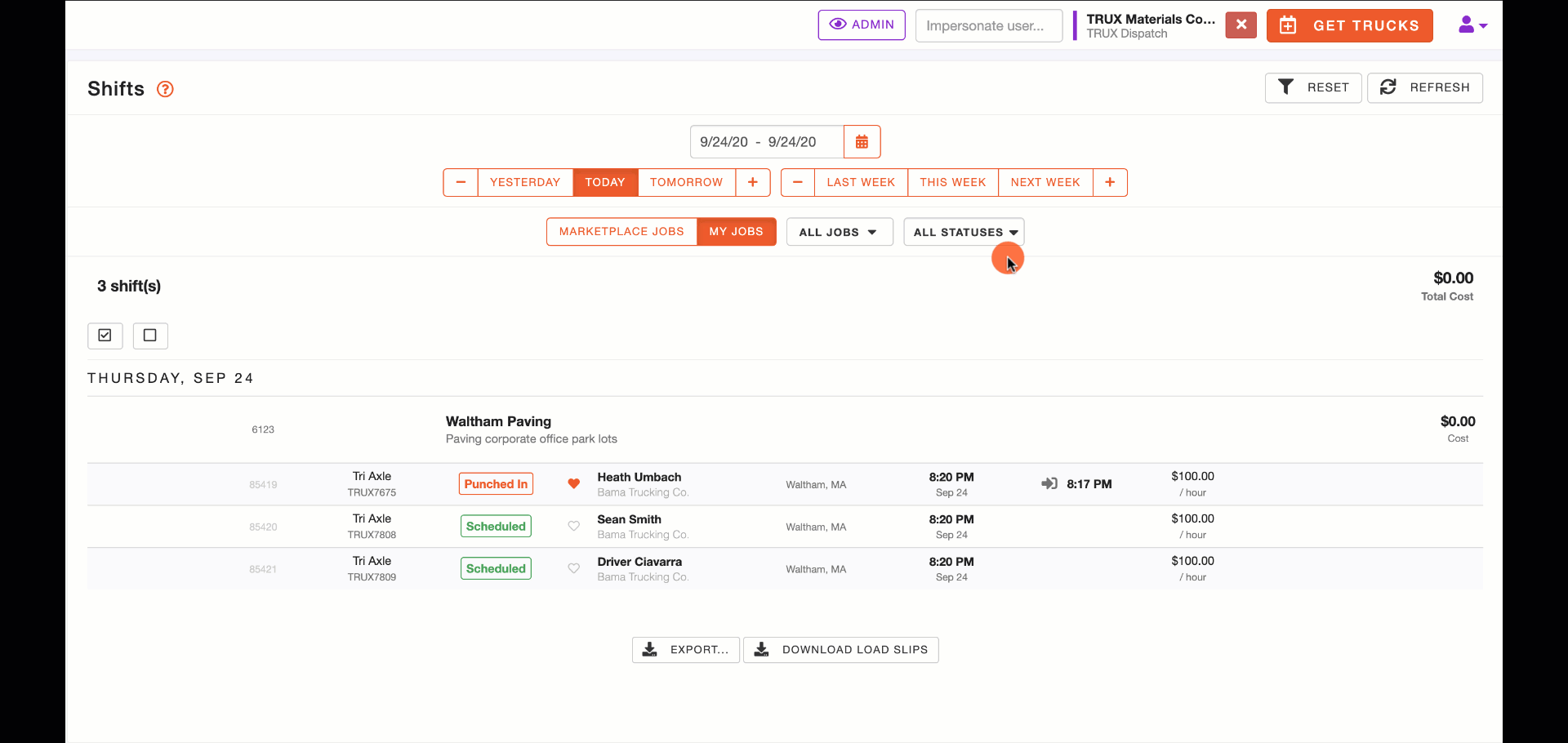
Click SHIFTS on the left navigation menu.

View all of your shifts for the selected date(s) and job(s).
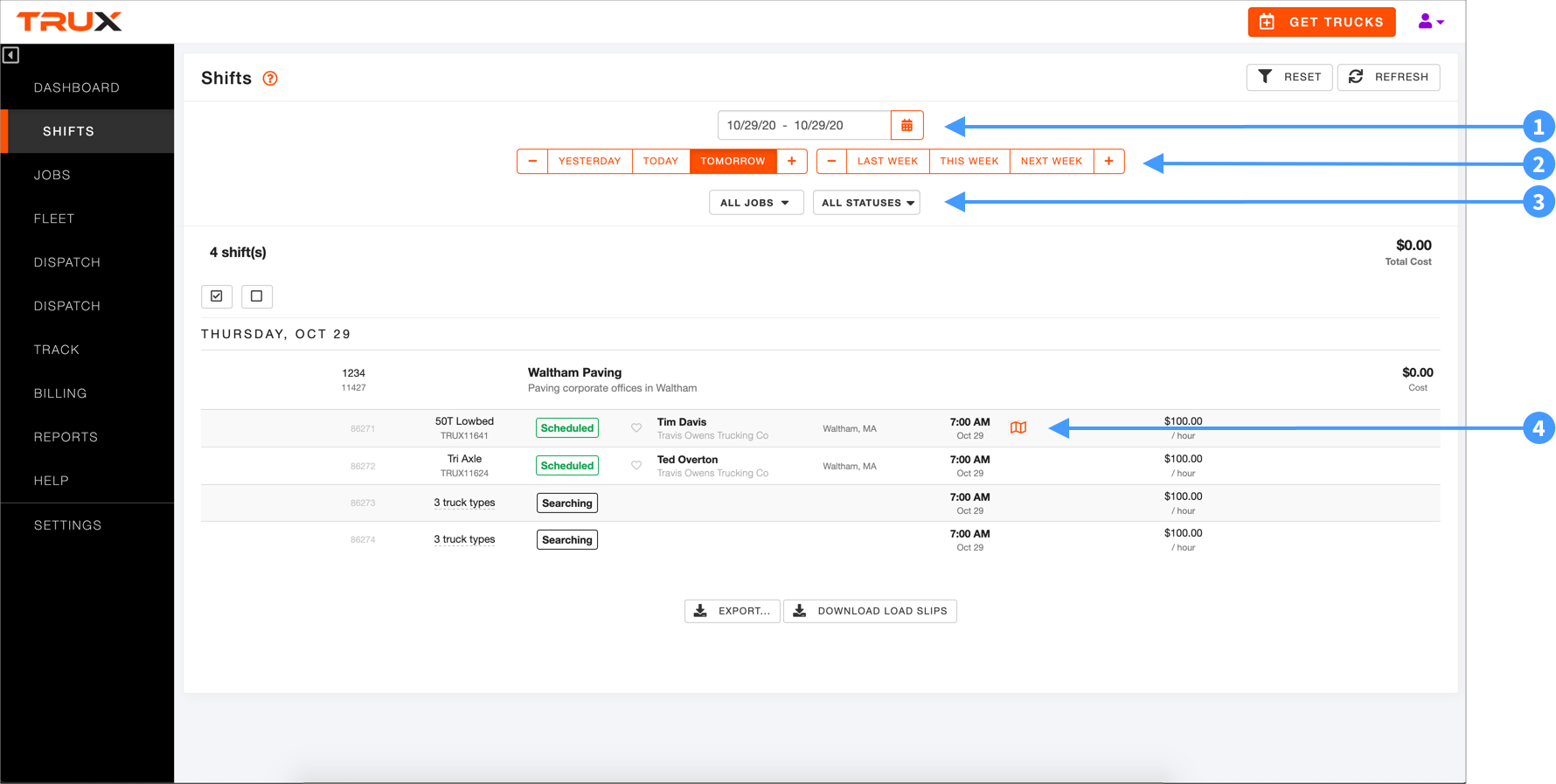
- Data Selector - Select a specific date or a date range.
- Day/Week Selector - Select a relative day (e.g., TODAY, YESTERDAY, etc.) or week.
- Job and Status - Click the drop-down lists to select a specific job and/or one or more shift status options.
- Map - Hover your mouse over a shift to reveal the map icon. Click the map icon to view the hauler on a map.
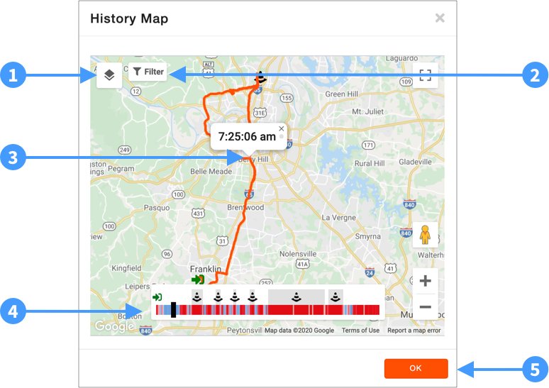
- Satellite View - Click this icon to switch from Map to Satellite view. Click it again to change it back.
- Map Filters - Click Filter to view or hide hauler Speed, start and end location Geofence, Points of Interest, and Truck Markers.
- Hauler Route - The hauler's route throughout the day is shown on the map.
- Hauler Slider - As you click and drag the slider, you will see the approximate time that the hauler was at the displayed location. The slider also reveals the hauler's relative speed along the route. Blue bars = faster progress. Red = slower progress. You can also see when and for how long (gray shade) the hauler was at the START (plant) and END (job site) locations as well as when they punched in and punched out.
- OK - Click OK to close the map.
Track haulers from the TRACK screen
You can track haulers directly, in real-time and on past shifts, on the TRACK screen.
See how
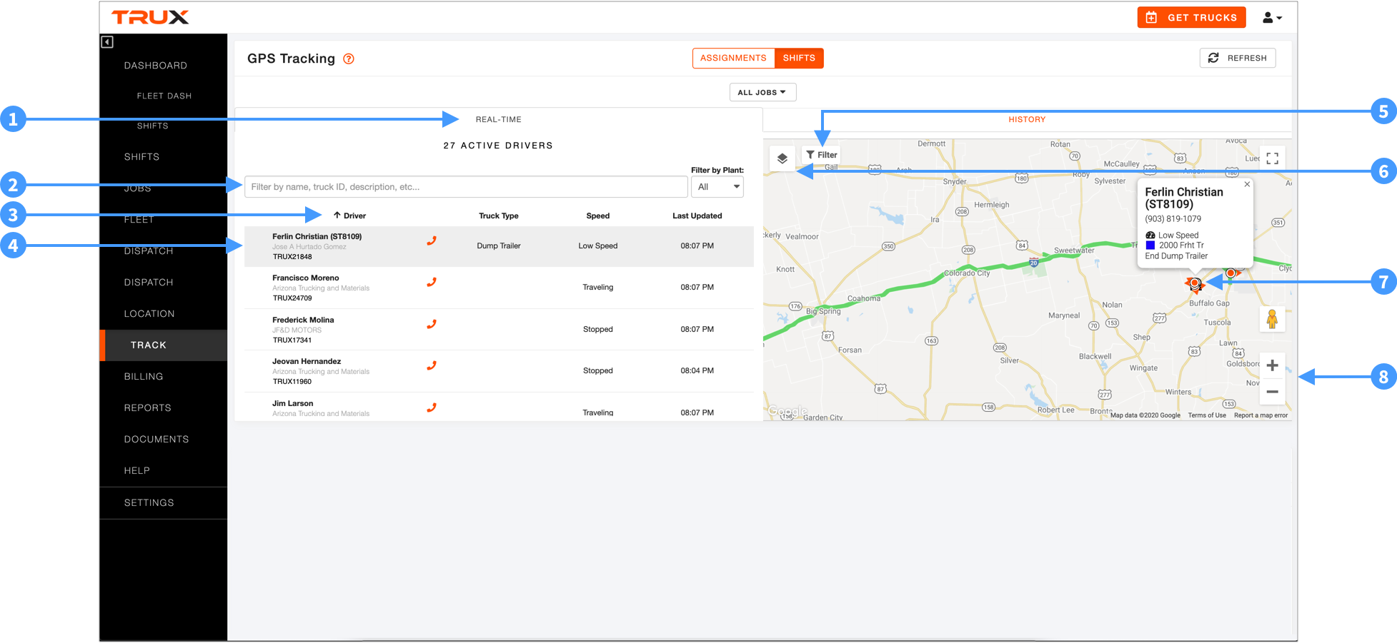
Click the Real-Time tab.
- All active drivers will be listed on the left. Search for a driver and/or filter drivers by plant. Click a column header to sort by Driver, Truck Type, Speed, or Last Updated time. Estimated speed values are defined by the following ranges:
- Unknown - speed cannot be estimated
- Stopped - estimated to be traveling under 2 mph
- Low Speed - estimated to be traveling between 2 mph and 20 mph
- Traveling - estimated to be traveling over 20 mph
- Click a hauler to show the hauler's location, phone number, relative speed, truck color and truck type on the map.
- Click "+" or "-" to zoom in/out on the map. Click, hold, and slide your mouse to reposition the map.
- Click Filter to add or remove traffic conditions, start/end geofences, and points of interest.
- Click the map icon to toggle between map and satellite view.
Click the History tab.
- Click a hauler to identify the hauler's route on the map.
- Click "+" or "-" to zoom in/out on the map. Click, hold, and slide your mouse to reposition the map.
- The hauler's punch-in and punch-out time and location will be shown on the map as well as all geofence entry and exit times.
- Click and drag the speed slider to reveal the time that the hauler was at each location along the route. Red indicates slower speeds, blue faster speeds.
- Click Filter to add or remove the speed slider, start/end geofences, points of interest, or trucker markers
- Click the map icon to toggle between map and satellite view.
Show me how
Click the button below to be guided through how to do this within TRUX.

Read how
Click TRACK on the left navigation menu.

Click the REAL-TIME tab.
- Click the REAL-TIME tab to see haulers who are punched-in on shifts.
- Search for punched-in haulers by name, truck ID, etc.
- Click a column header to sort haulers by that column. Relative speed values are defined by the following ranges:
- Unknown - speed cannot be estimated
- Stopped - estimated to be traveling under 2 mph
- Low Speed - estimated to be traveling between 2 mph and 20 mph
- Traveling - estimated to be traveling over 20 mph
- Click a punched-in hauler to display that hauler's current location on the map.
- Click Filter to turn on/off Traffic Overlay, start/end location Geofences, and/or Points of Interest.
- Click the map icon to toggle between map and satellite view.
- The selected hauler's current location is shown on the map as well as a "hauler card" showing their name, Truck ID, phone number, relative speed, truck color, and truck type.
- Click +/- to zoom in/out on the map.
Click the HISTORY tab.

- Click the HISTORY tab to see haulers who are punched-in on shifts.
- Search for haulers by name, truck ID, etc.
- Click a column header to sort haulers by that column.
- Click a hauler to display that hauler's route on the map.
- Click Filter to turn on/off Speed, start/end location Geofences, Points of Interest, and/or Truck Markers.
- Click the map icon to toggle between map and satellite view.
- The timestamped location of the trucker along their route.
- Click and drag the speed slider to reveal the time that the hauler was at each location along the route. Red indicates slower progress, blue faster progress. The hauler's punch-in and punch-out time and location will be shown on the map as well as all geofence entry and exit times.
Comments
0 comments
Please sign in to leave a comment.